The New First Line of Defense: Building Community Resilience through Residential Risk Disclosure
The first line of defense in reducing risk to human life and property during disasters is residing in a safe and secure home, protected from natural hazards (e.g., floods, storm surge) and their associated impacts. and associated health hazards (e.g., post-traumatic stress, injury, mold). Safe housing should be equitably available and not just accessible to those either knowledgeable enough to identify local hazard impacts or wealthy enough to purchase disaster mitigated homes. Residents believe that building codes and zoning are designed to keep them safe, yet few understand that these regulations are ‘minimum safety standards’. Even fewer realize that these standards become quickly outdated as the environment, local development patterns, material science, and construction practices change. Absent new regulatory mandates for stricter building codes, retrofitting, or zoning, only voluntary decisions by residents will increase their household resilience, protect their property, and reduce harm. This project addresses this deficiency by educating residents on how much risk they are accepting when buying or renting a home and what they can actively do (or afford) to lower the risk. Empowering residents with hazard information and how they can use it may have far reaching consequences on local housing stock values and increase demand for safer housing. This project aims to provide all community members with information on (1) local hazards/related impact history, (2) housing stock structural vulnerabilities, (3) building-level mitigation measures (costs) tenants can take/advocate for to live safer, and (4) community-scale mitigation actions jurisdictions can implement to better protect lives and property.
We will analyze present-day individual hazard probabilities based on observational and reanalysis data as well as model hindcasts (for storm surge) using empirical and theoretical extreme value distributions. The latter can be used to assess probabilities of rare events beyond the observational range to quantify the likelihood that critical thresholds will be exceeded over a given time period (e.g. the lifetime of a mortgage), and can possibly also be employed for Monte Carlo simulations to inform the work on residential mitigation options conducted as part of the project. From the individual hazards we will develop aggregated multi-hazard scores that appropriately combine the individual hazards of interest for the purpose of the project. This could include different weight factors for different hazards based on their relevance in terms of housing decisions and resilience (which are likely different for different locations and possibly also for different users of the score). The weighting should also account for uncertainties and sensitivities, which will likely vary across hazards and the associated drivers, for example due to limitations in data availability. Changes in future probabilities of individual hazards and the multi-hazard score(s) will be assessed using climate projections of selected relevant variables. Two of the key climate indicators are sea level rise and changes in temperature, both of which have direct effects on the wellbeing of coastal communities. Localized sea level rise scenarios will be used in combination with estimated rates of vertical land motion (at least in the northern Gulf of Mexico), as these can be multiple times larger than the sea level rise itself (depending on the underlying greenhouse gas emission scenario and target period). Relative sea level rise scenarios will be combined with storm surge statistics to assess changes in the frequencies of critical threshold exceedances. Projected changes in temperature (possibly leading to more intense and/or more frequent heatwaves or cold spells) will be derived from downscaled climate model outputs. The same is true for extreme precipitation events. The key deliverables are individual hazard probabilities and multi-hazard scores (combining different individual hazards and assigning weights) and projected changes through time. This work is directly linked to the following objectives:
- Disclose past, present, and future threats from natural hazards.
- Co-develop municipal strategies and policies to manage resilient and equitable location and housing decisions.
We will also provide support in conducting choice experiments and the development of associated models, including the assessment of willingness to pay for more resilient housing in the light of existing and estimated future risks. The work is linked to the following RQs:
- How much of a premium are homebuyers willing to pay for various levels of future loss reduction through mitigation to reduce their natural disaster risk?
- How does homebuyer willingness to invest in mitigation change when framed in the context of known, fixed future costs (i.e., discounts in insurance premiums) versus uncertain future costs (i.e., likely hazard loss reduction)?
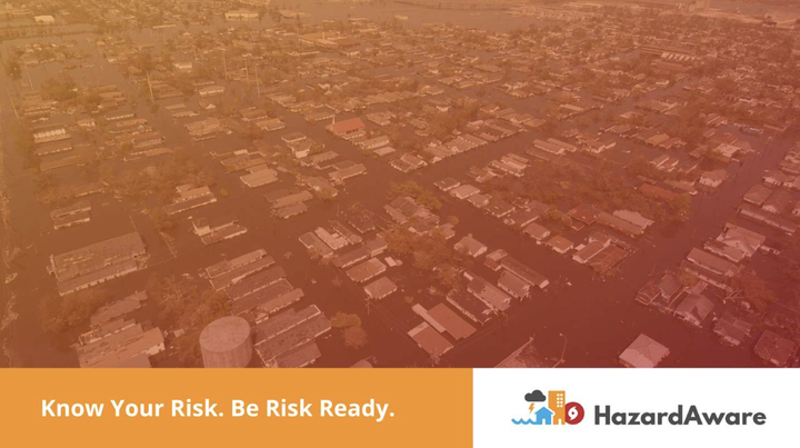
If you are a U.S. Gulf coast resident and want to know your houses/communities risk to hazards, check out our HazardAware tool to get information on natural hazard loss, frequency, and mitigation for residential buildings at a specific address.
Funding Agency: National Academies of Sciences, Engineering and Medicine Gulf Research Program
Javed Ali
Water Resources Engineer & Climate Data Scientist
Experienced Water Resources Engineer and Climate Data Scientist focused on multi-hazard risk assessment, climate risk modeling, and developing science-informed data-driven solutions for resilient water systems, infrastructure and communities.
Publications
Project DOI AGU2021 Session PDF Full Presentation Video Follow
Talks
Dissecting Flood Losses Along the United States Gulf and East Coasts

Assessing Socio-economic Impacts of Compound Flooding for U.S. Coastal Communities